Precipitation in peninsular Spain. Influence of teleconnection indices and spatial regionalisation

Resumen
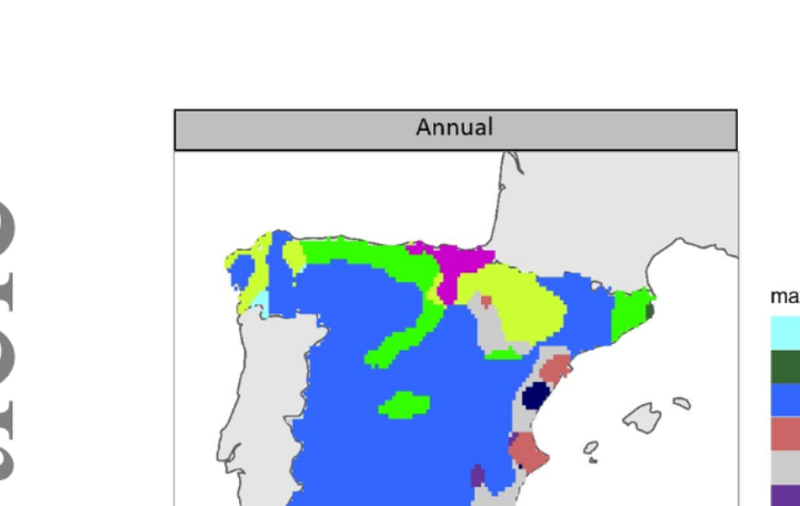
Precipitation constitutes a particularly variable climatic element in Spain. Study of teleconnection indices, closely related to precipitation, enables us to establish to a greater or lesser degree the mechanisms regulating pluviometric variability; these are vital for planning and managing water resources in semiarid regions. In the present article we attempt to identify the low-frequency patterns that present the closest statistical relationship with rainfall for each of the points on the MOPREDAS pluviometric data grid, covering the whole area of peninsular Spain. The results obtained reveal the clear dominance of Mediterranean Basin patterns, specifically of the Mediterranean Oscillation (MO) and of its version in the mid-levels of the troposphere (ULMO). Results, however, show a significant dominance of the Western Mediterranean Oscillation (WeMO) in the east of the Iberian Peninsula and the eastern part of the Cantabrian façade. Also noteworthy is the control exerted by the NAO over much of the centre and southwest of Spain, as well as the surprising dominance of an index that heretofore has not been used much, known as the Paris-London Westerly Index. Finally, we performed a regionalisation based upon the correlations between the teleconnection and precipitation indices by means of a principal components analysis, which revealed the existence of three differentiated pluviometric regions in peninsular Spain. Atlantic (centre and south), Mediterranean (east) and Cantabrian (north).